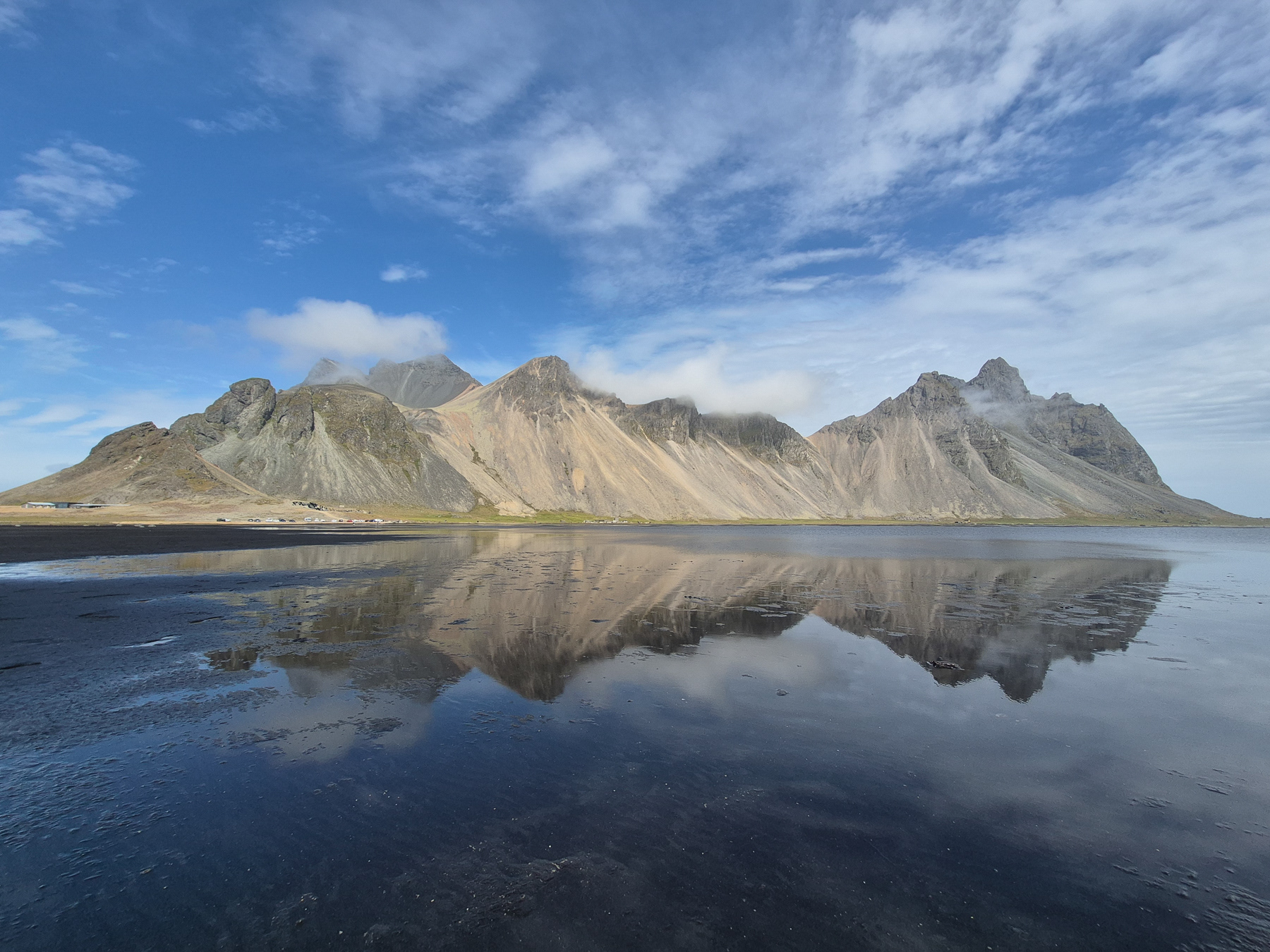
Vesturhorn mountains at Stokksnes, Suðurland, Iceland, July 2025
The biggest region of Iceland is Suðurland, the Southern Lands. In fact, it is that vast that I chose to split my stories from here in different parts. When visiting Iceland for a limited number of days, one will have to make choices - either stay longer in a region or experience a few gems and continue. As July 2025 marked my first visit to the country, I chose the latter.
Eastern Suðurland is basically one municipality: Sveitarfélagið Hornafjörður, or often simply called Hornafjörður. Here, one has the easiest access to Europe's biggest glacier outside Russia, find pointy mountains with beautiful reflections and can take the little less touristic hike of a gorgeous canyon.
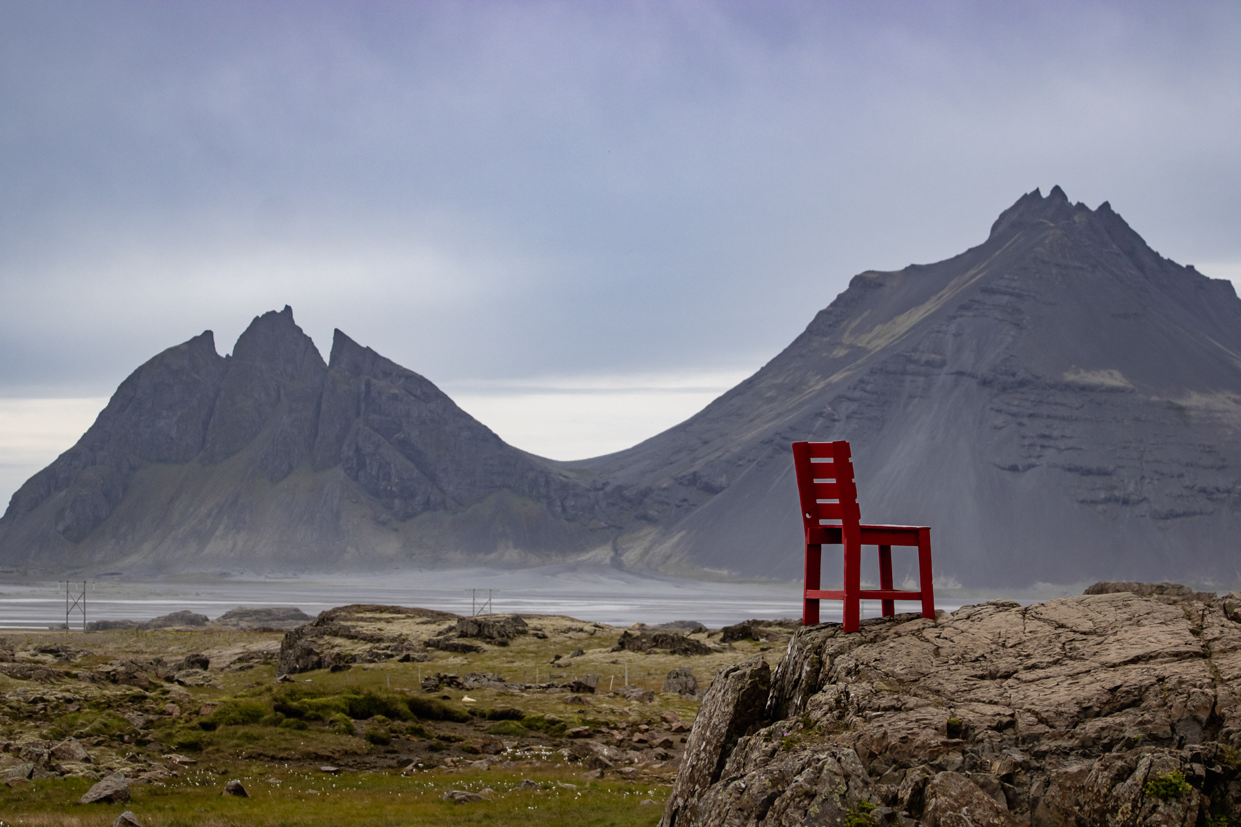
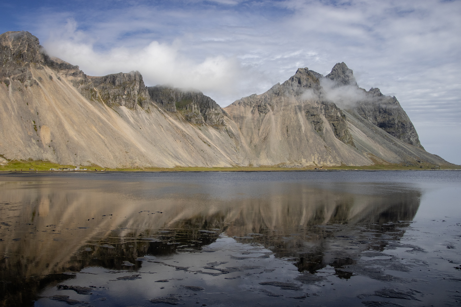
Vesturhorn mountains and Stokksnes
Driving along the southern coast of Iceland, Vesturhorn is a piece of land not to miss. The mountains at sea look spectacular coming from the east over road 1, and they look extravagant when getting around them and seeing them from the south side - including the reflections when the sea is calm.
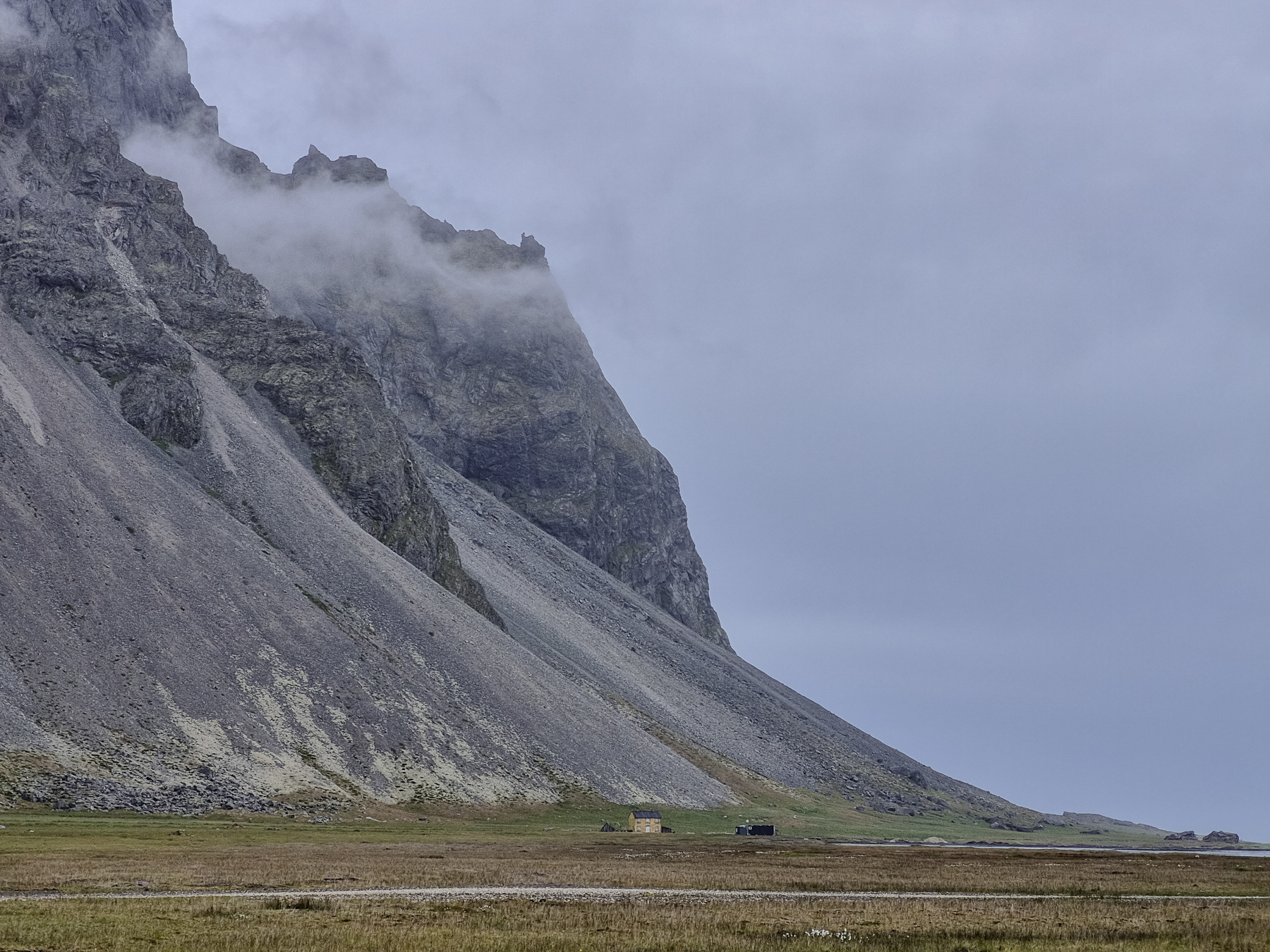
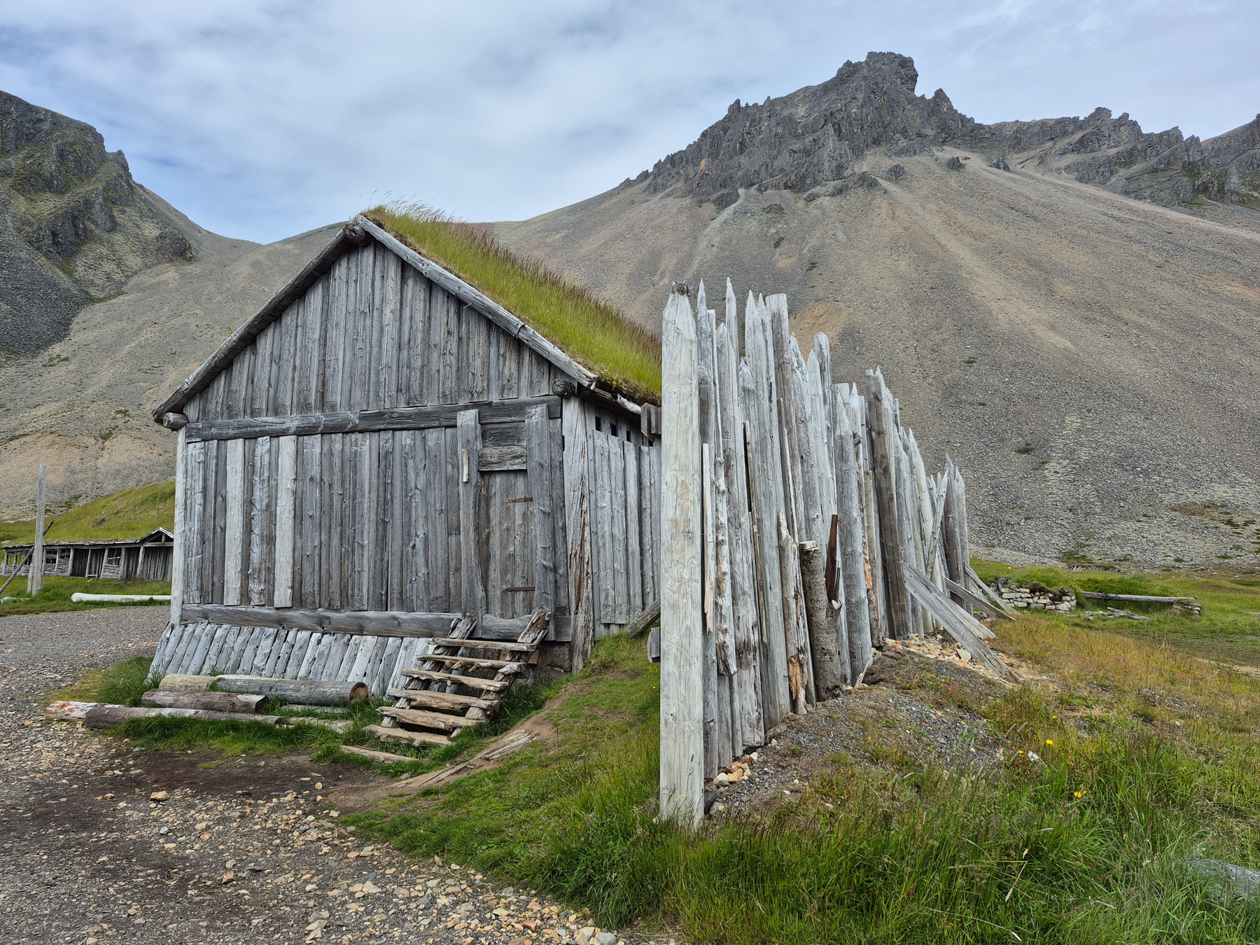
At the southern foot of the Vesturhorn mountain there is even a Viking village. Built for a film but never finished and never used, it is a fun addition.
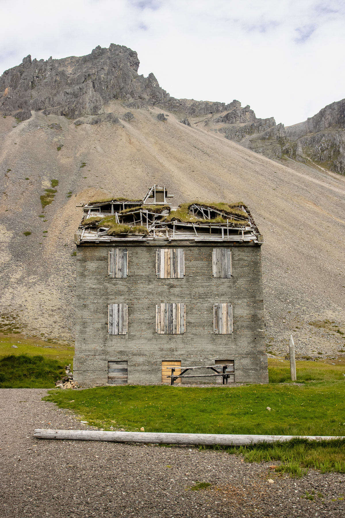
An abandoned house.
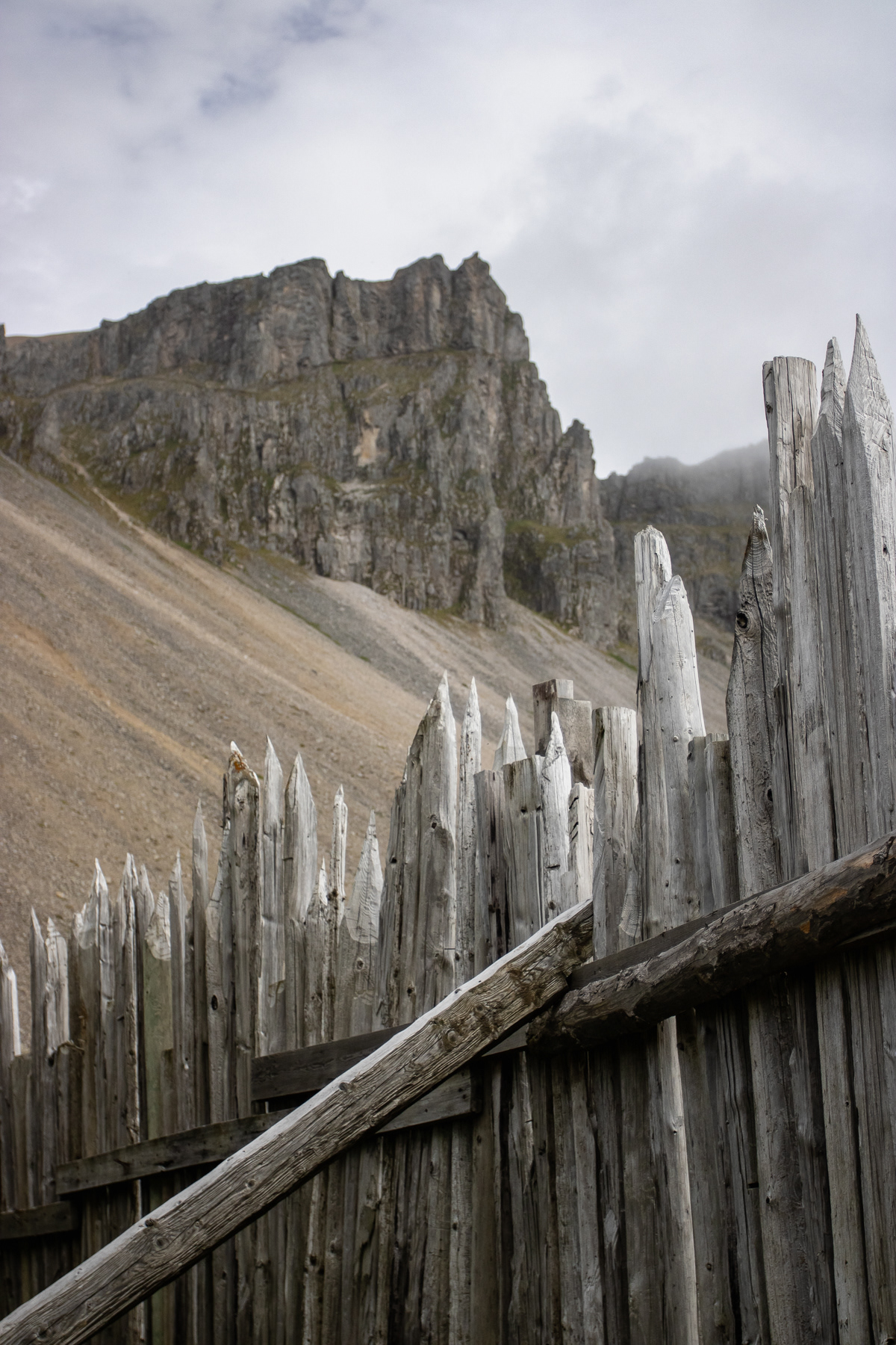
The wall of the Viking village.
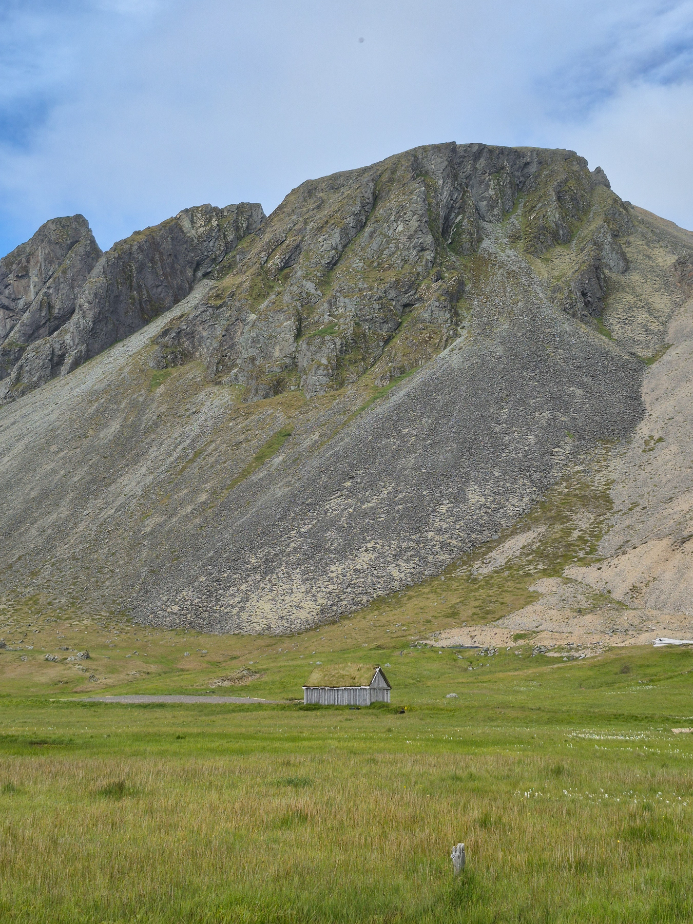
A lone wooden storage, covered with grass.
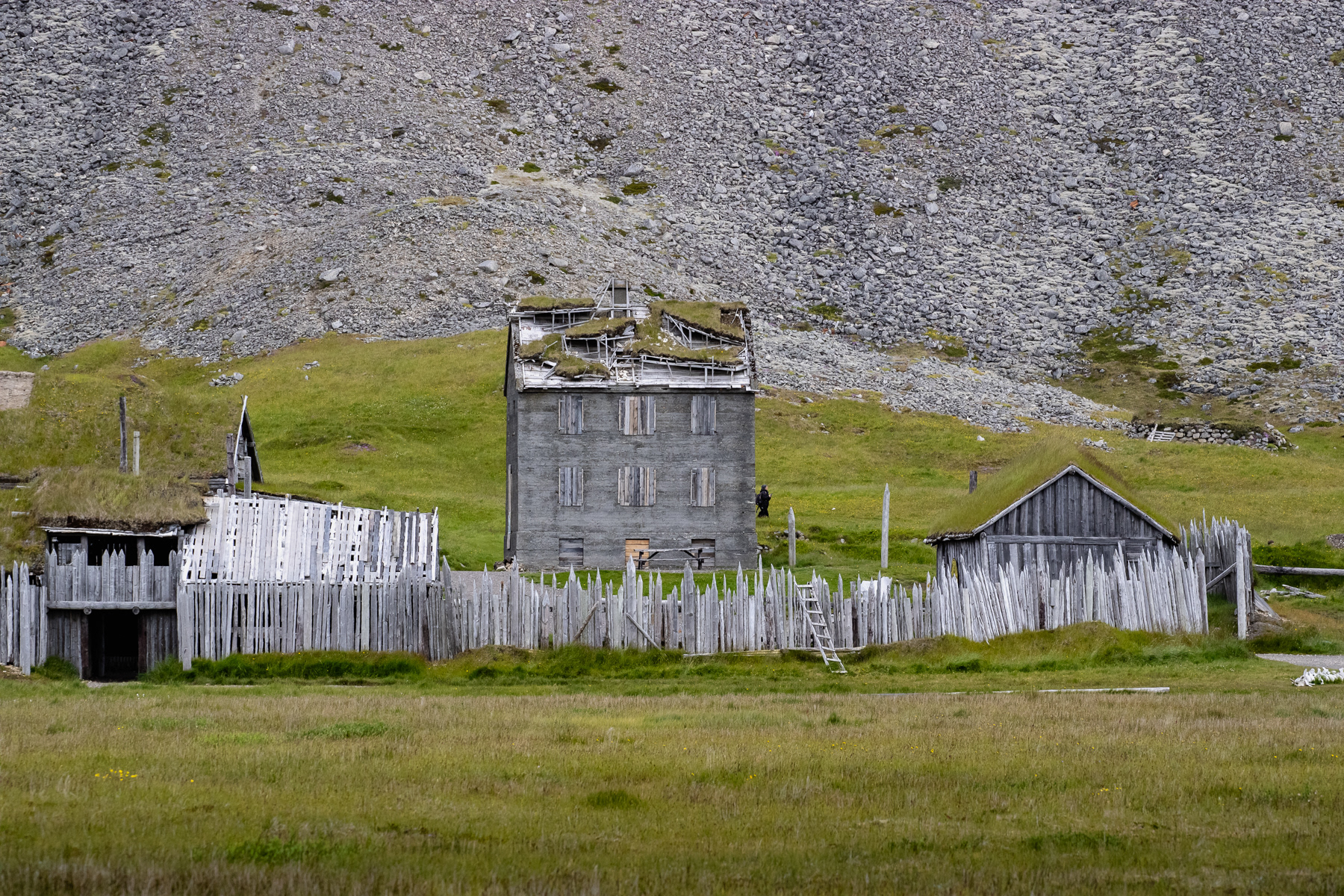
The Viking village built to serve as a film set that never was.
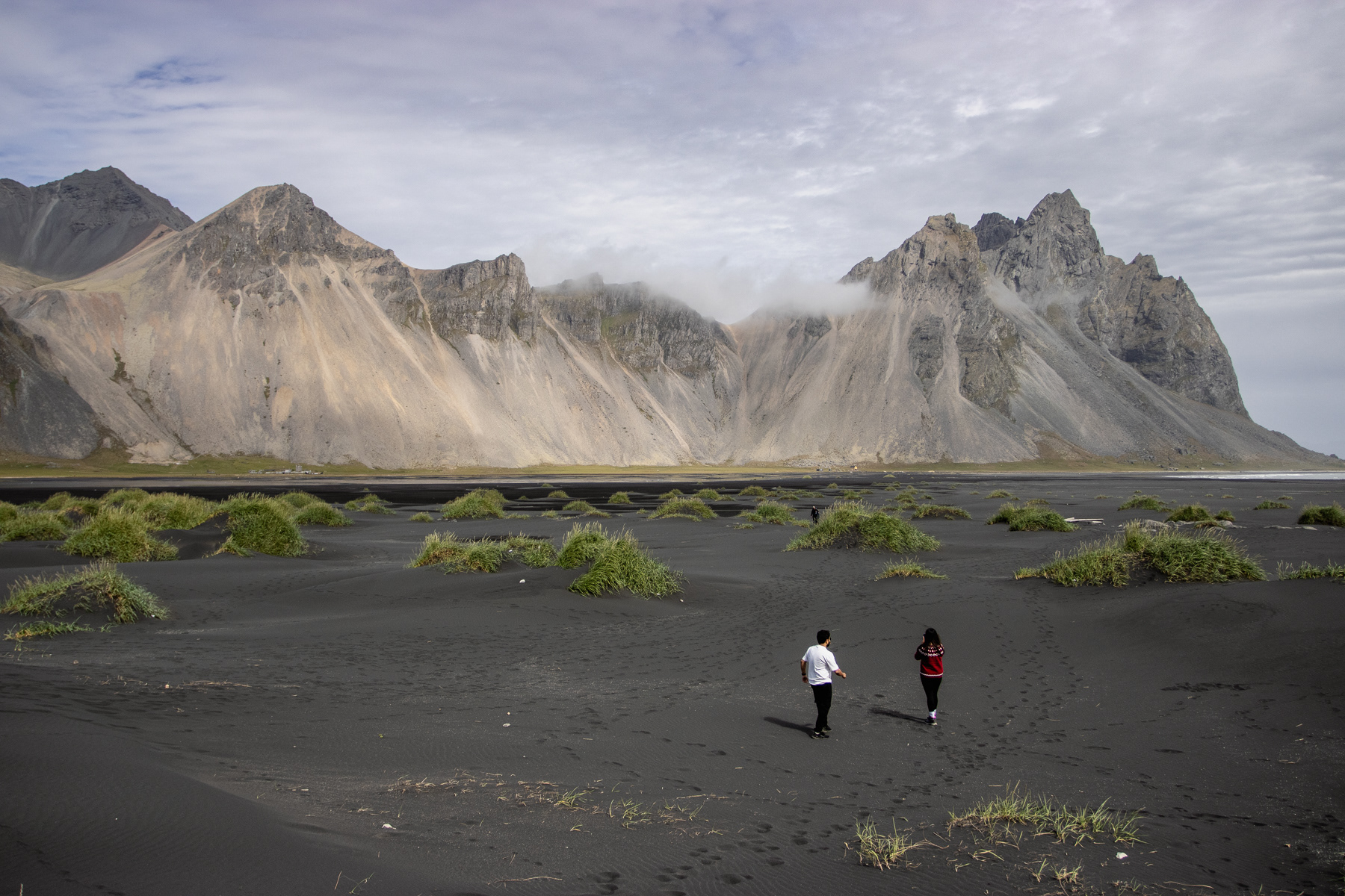
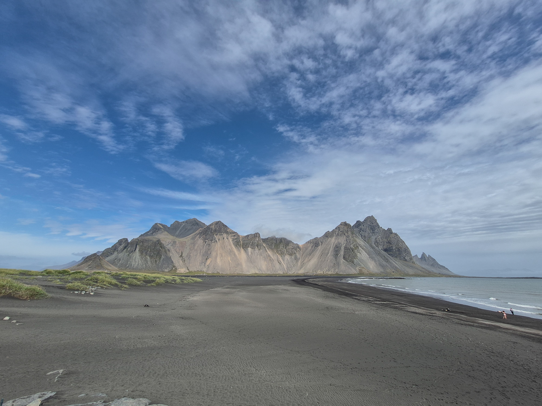
A black sand beach and the Vesturhorn mountains at Stokksnes.
Vatnajökull glacier and Jökulsárlón glacier lake
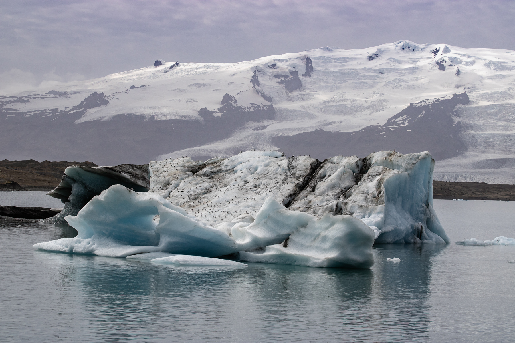
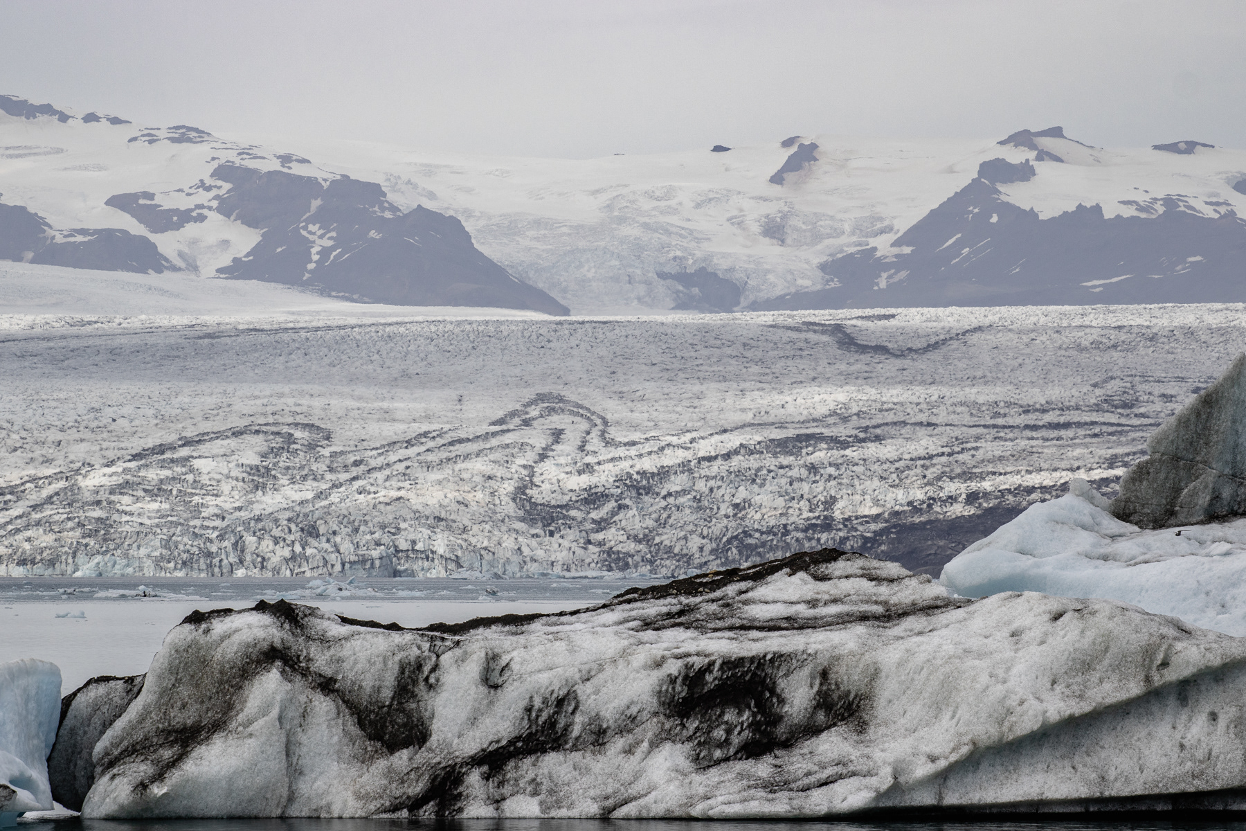
The Vatnajökull in Eastern Suðurland is Europe's largest glacier apart from one in Novaya Zemlya (Nova Zembla) in Russia. And from the southern ring road 1 it is very easy to approach. The numbers are baffling: the 7,700 km2 of ice covers about 10% of the entire main island, 380 metres (1,250 feet) on average peaking to 950 metres (3,120 feet) and including Iceland's highest peak of Hvannadalshnúkur (2,110 metres / 6,921 ft).
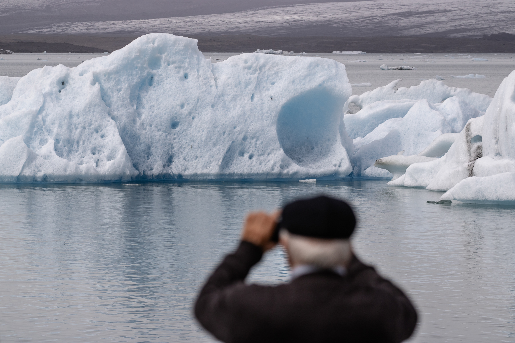
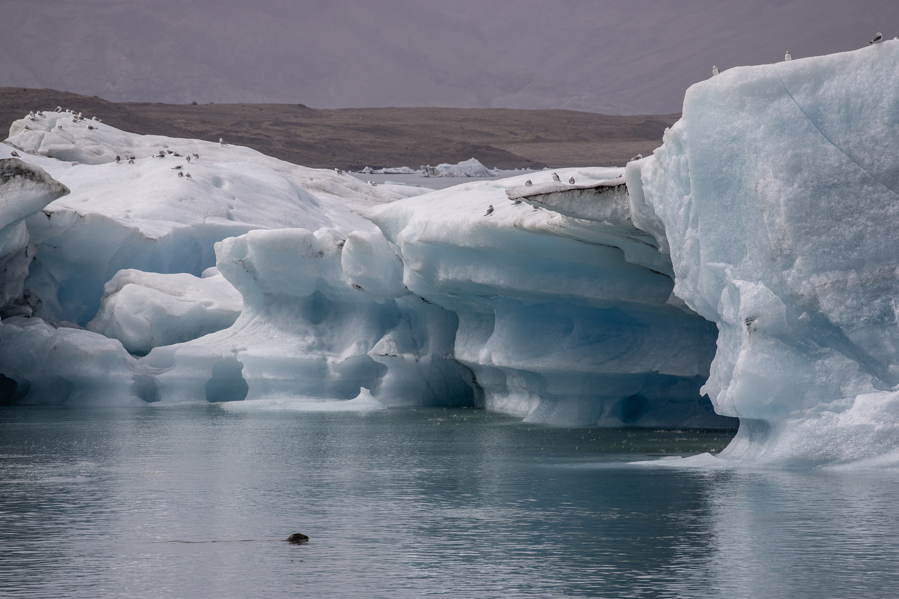
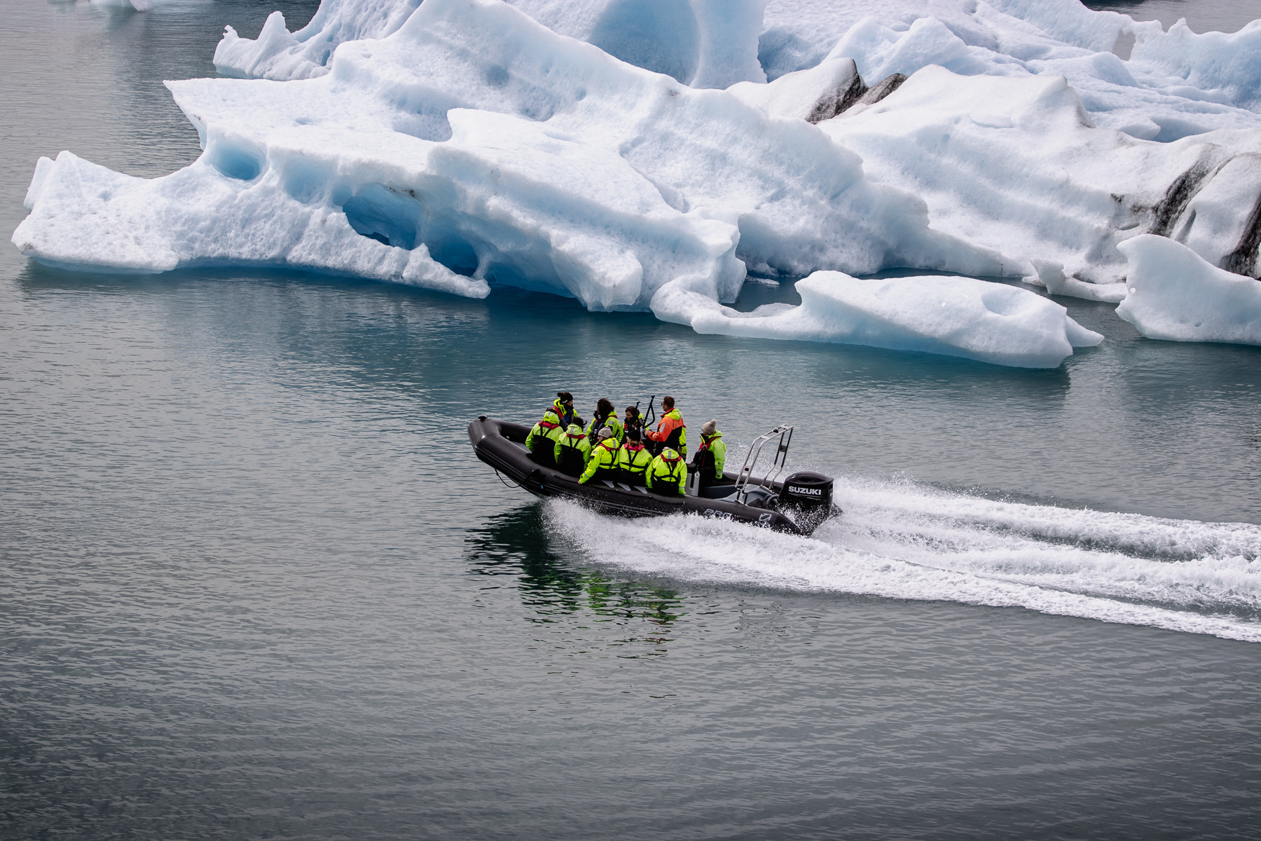
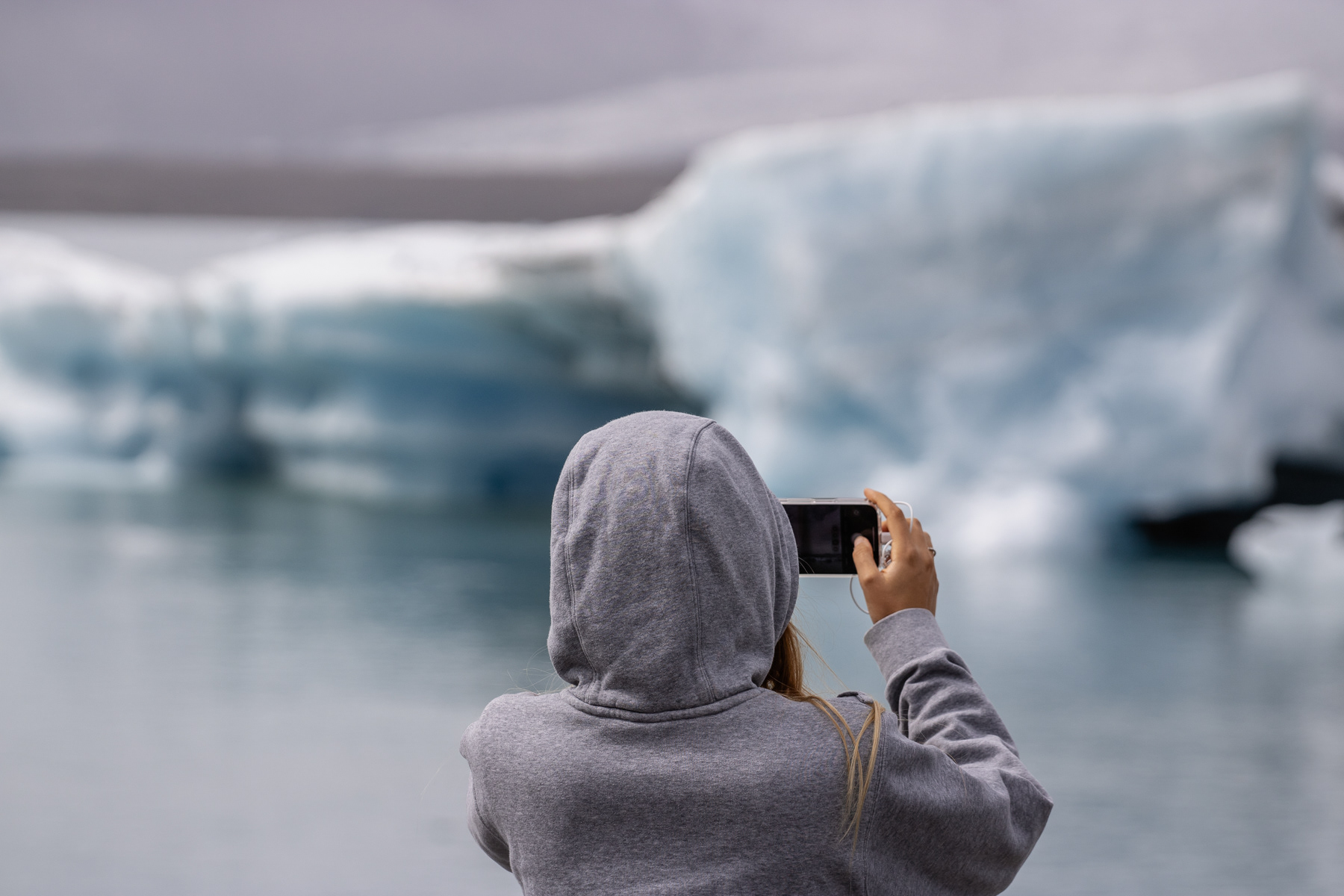
But, like the world's other glaciers, the Vatnajökull is retreating. The Jökulsárlón glacier lake in which the glacier deposits melted off chunks of its ice cap used to be part of the glacier in the beginning of the 1950s. In 1998 it still covered half of the lake that now let tourist float by amphibian vehicle.
The cool thing of the melting off ice chunks is that at the end of the Jökulsárlón lake, bits and pieces tend to hit the beach before they can reach the Atlantic Ocean. This Diamond Beach is a touristic hotspot, but during my visit in July the number of ice pieces was not very impressive. But the lake and the glacier certainly were.
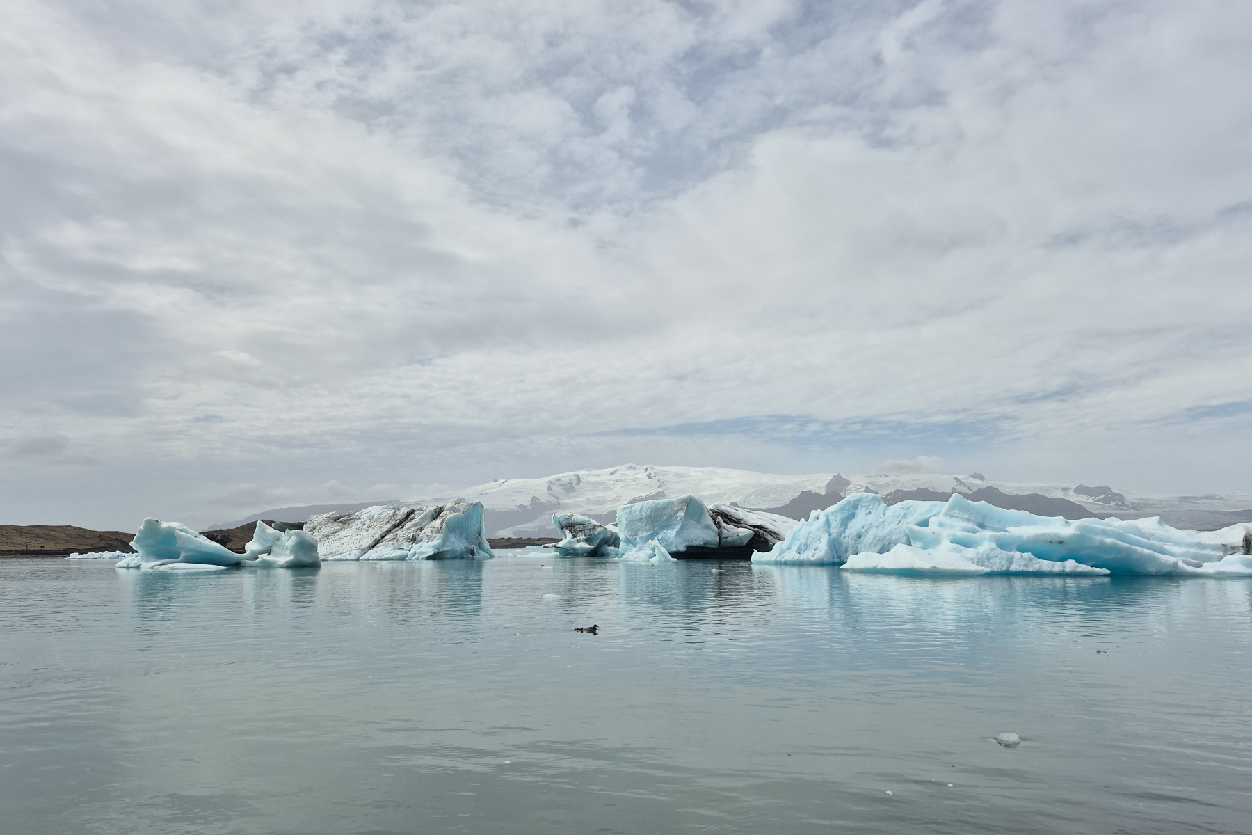
Jökulsárlón glacier lake with the Vatnajökull glacier in the background, July 2025.
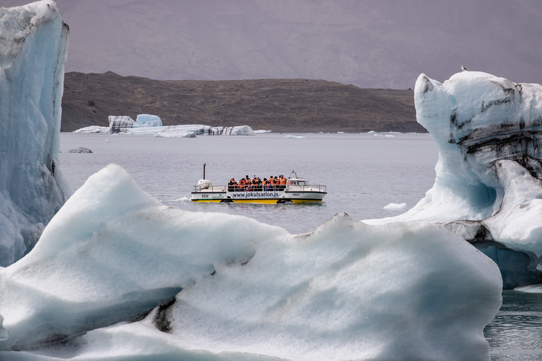
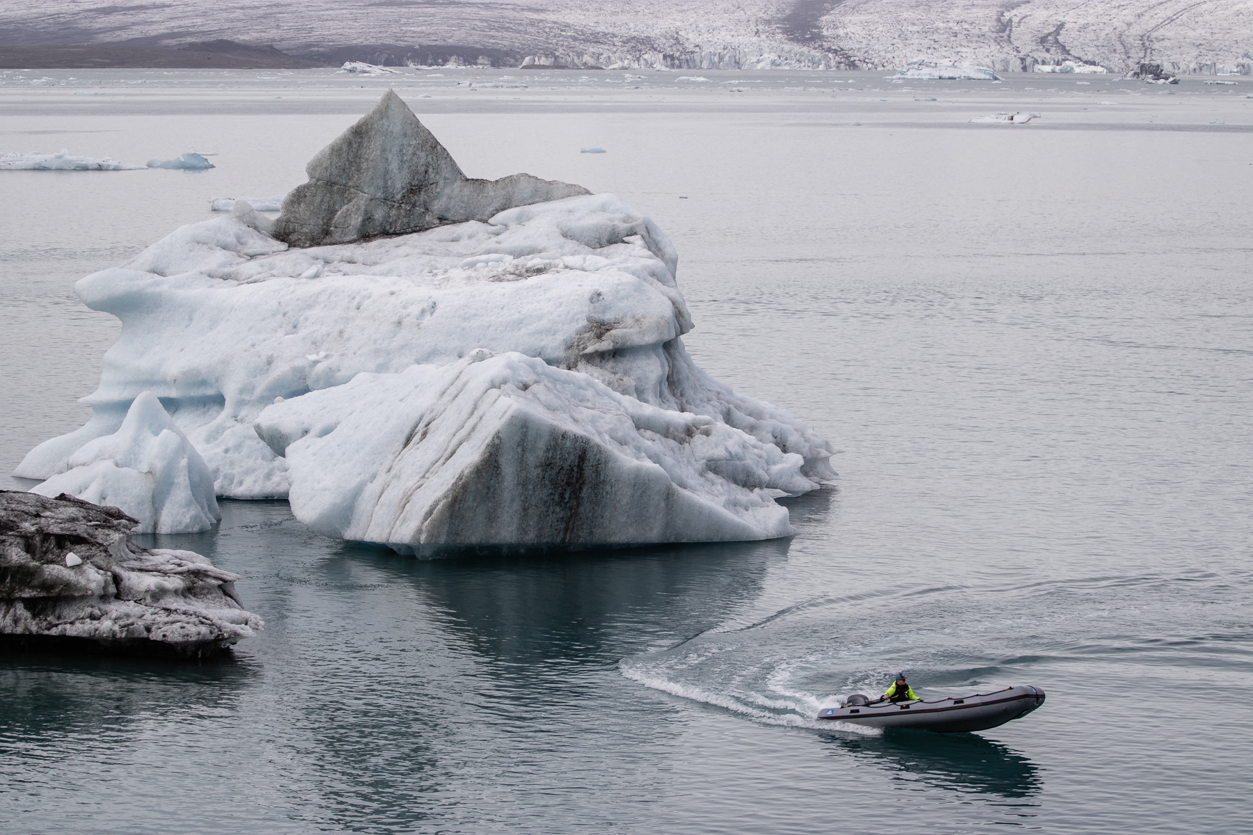
A rib with one safety employee cruising through the glacier lake.
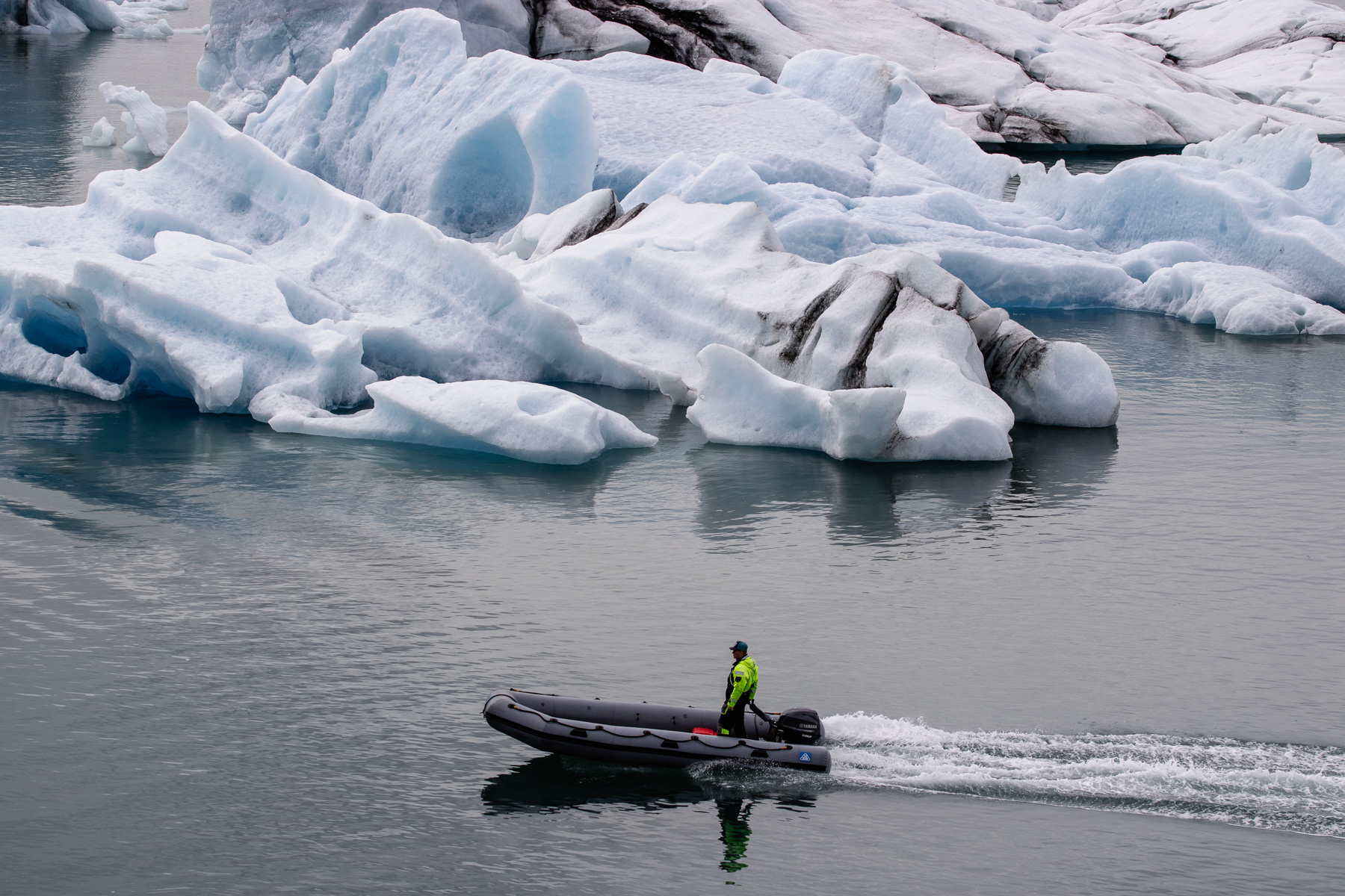
A rib with one safety employee cruising through the glacier lake.
Mulagljufur Canyon
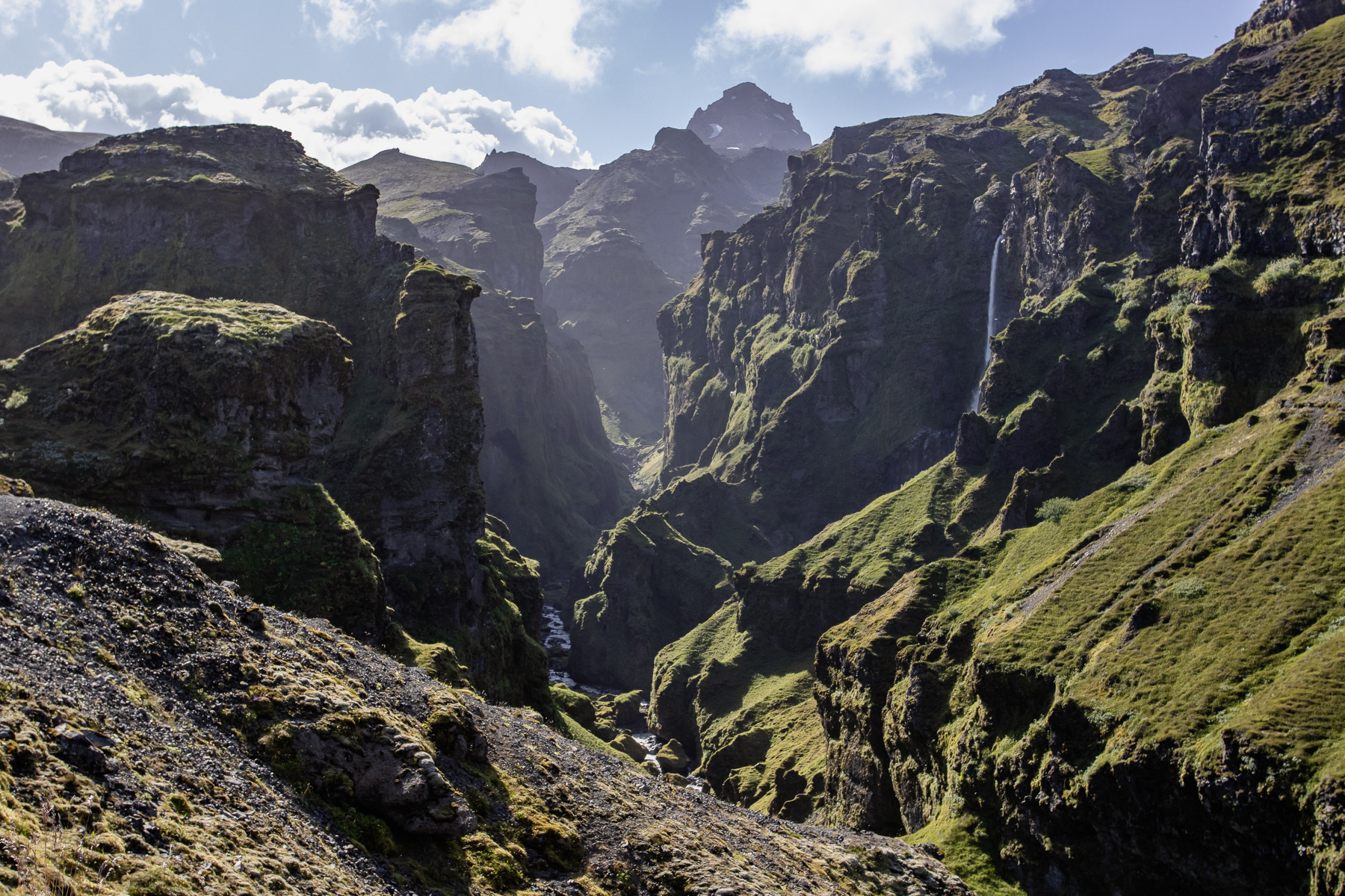
Hikers will be happy with the Mulagljufur Canyon in Eastern Suðurland. With a minimum hike of 2 hours to the first view points and back most tour companies ignore this green spectacle. Several times during the hike one has great views of the edges of the Vatnajökull glacier - and even Iceland's highest peak Hvannadalshnúkur is standing tall somewhere further up ahead (and out of reach for the more mortals).
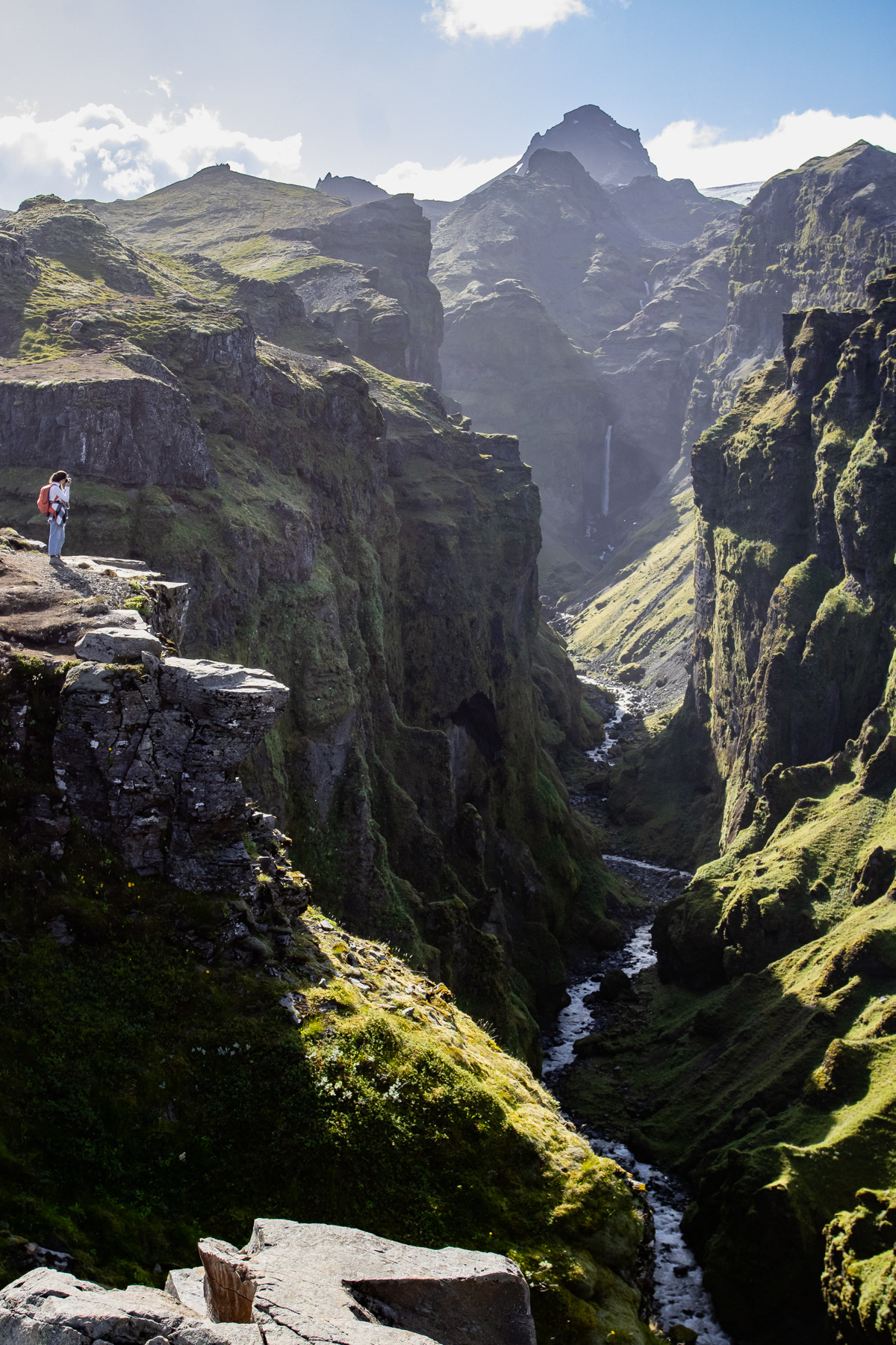
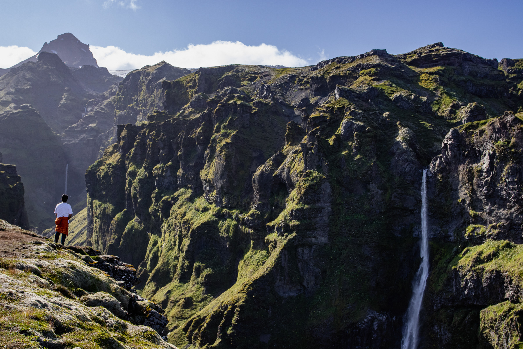
Waterfalls right and forward in the canyon.
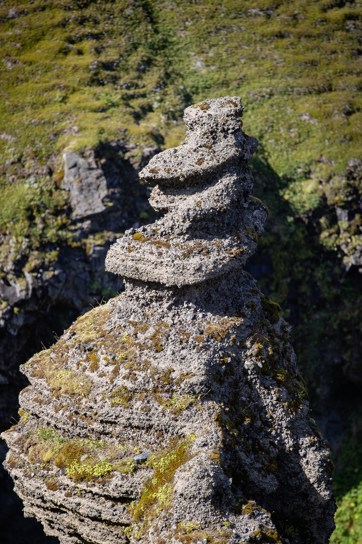
A natural formed giant statue of rock in the canyon.
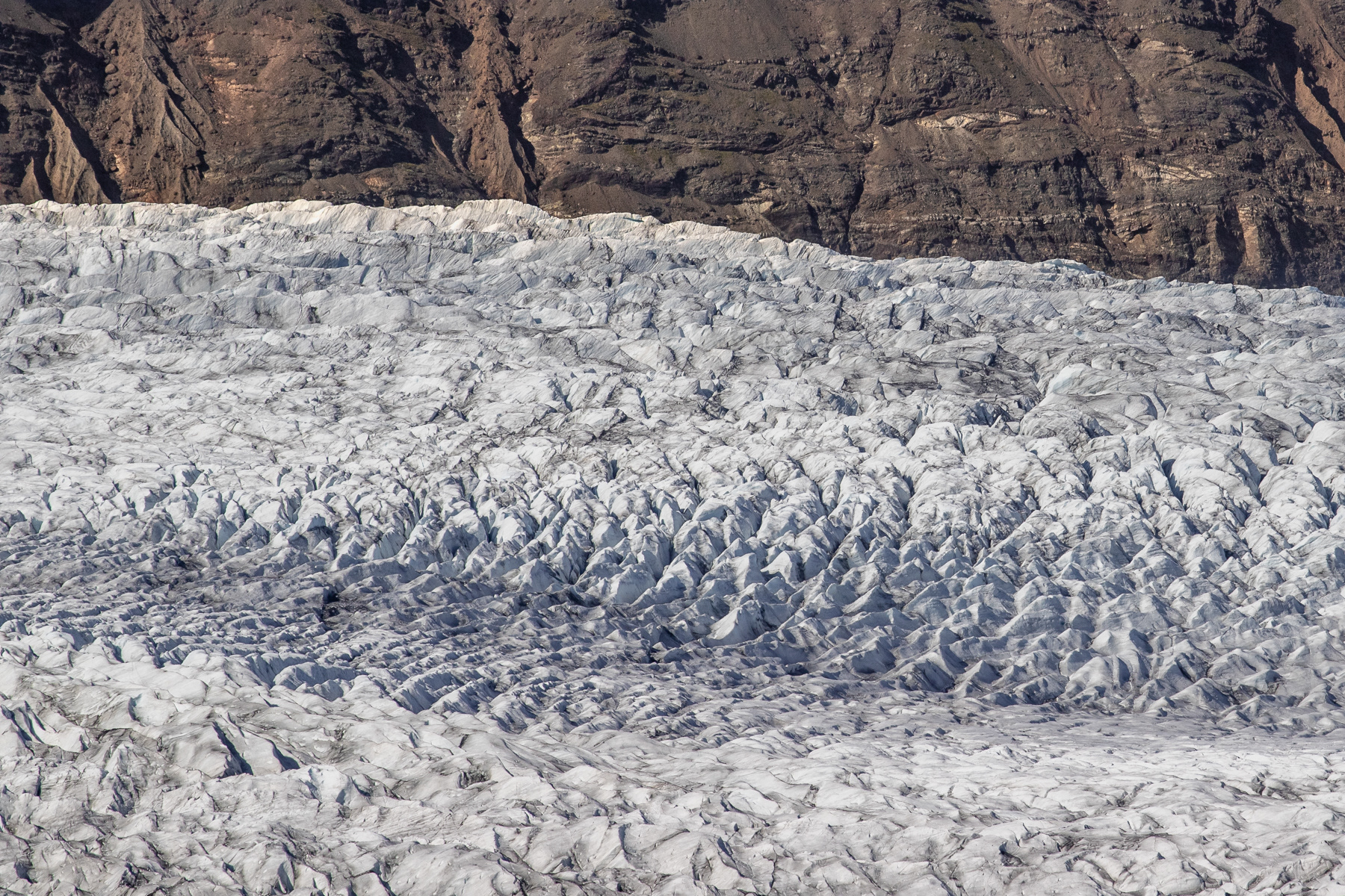
Detail of the glacier taken with "the long lens".
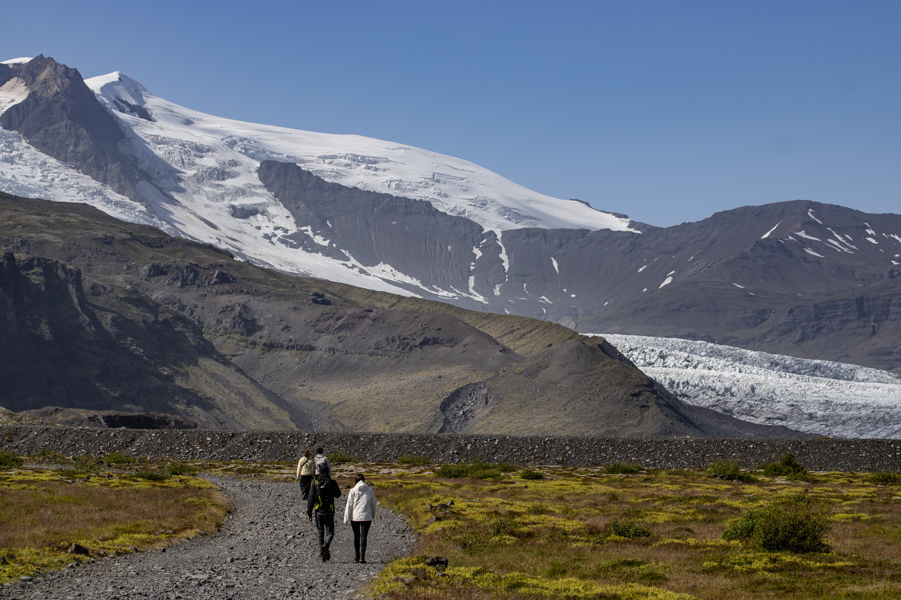
The trail into the Mulagljufur Canyon starts easy.